Entrar...
Criar Conta Portugal Please!
Comprar...
Criar Conta
Collect your Tourist Map of the Municipality of Vieira do Minho ...
Vieira do Minho is the second most mountainous municipality in the district of Braga. It occupies an area of 218.05 square kilometers, being limi...
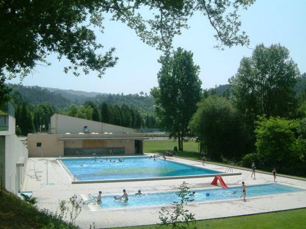
The municipal swimming pool complex consists of two essential structures ...
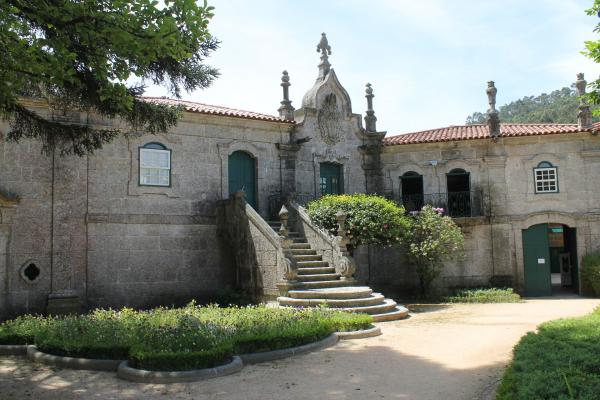
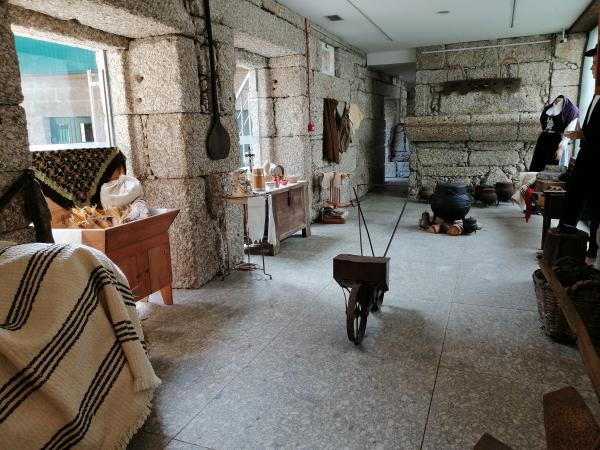
The Casa Museu Adelino Ângelo is housed in an old manor. It is an emblematic building whose architectural interest motivated the opening of a class...
. ...
Casa da Cultura is installed in an old manor house, Casa de Lamas, owned by the City Council, which is located in the center of Vieira do Minho. It...
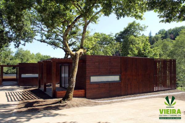
The Cabreira Camping Park is located a few meters from the village of Vieira do Minho. Protected by the green mountain, it allows a privileged cont...
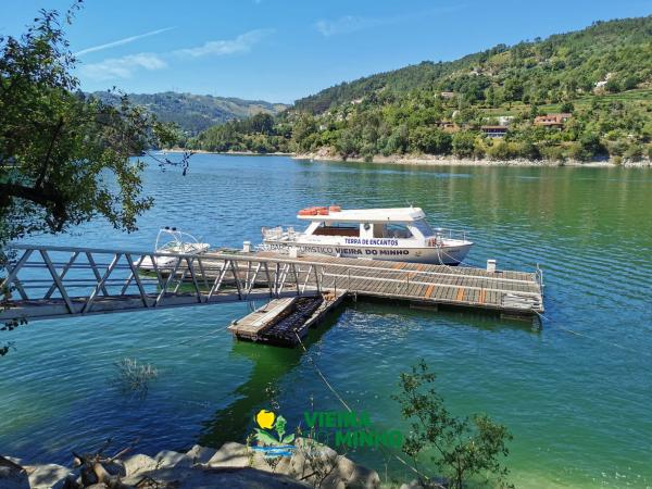
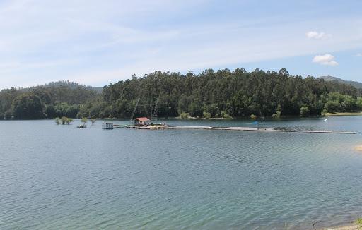
With his eyes on the water, visitors can discover the charms of Albufeira da Caniçada on board the Vieira do Minho tourist boat “O Brancelhe”. This...
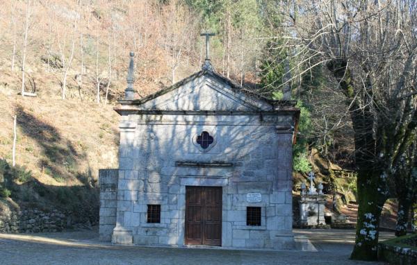
Located in the parish of Cantelães, the Chapel of Nossa Senhora da Fé was built in 1759 after the appearance of the image on the Monte de Santa Cec...
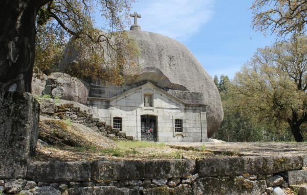
The Chapel of Nossa Senhora da Lapa, located in Monte do Penamourinho, parish of Soutelo, was built in 1694 at the behest of João Gonçalves and his...
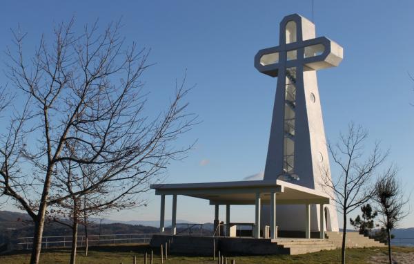
Located at the foot of the Serra da Cabreira, which provides you with a beautiful natural environment, the Sanctuary of Nossa Senhora da Orada is l...
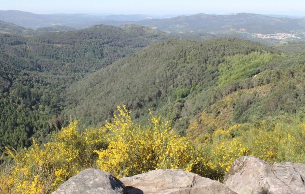
Set in the heart of Serra da Cabreira, the Serradela viewpoint offers a privileged view over Turio, a green area full of forest species and usually...
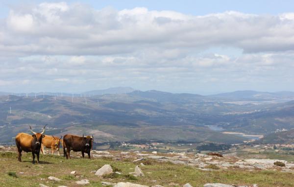
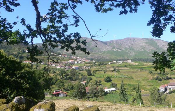
Serra da Cabreira is located in the separation between Minho and Trás-os-Montes, extending through the territories of Vieira do Minho, Cabeceiras d...
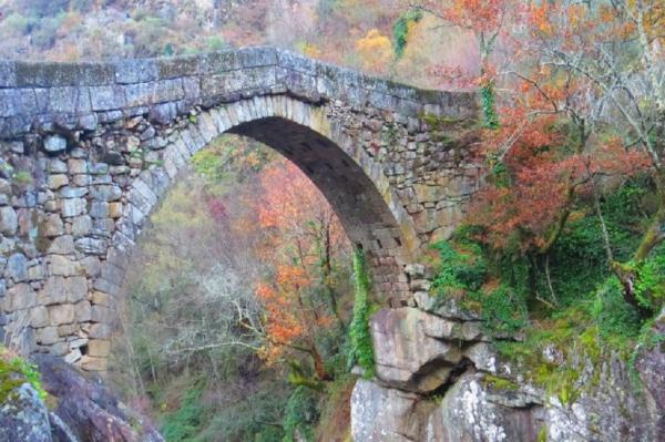
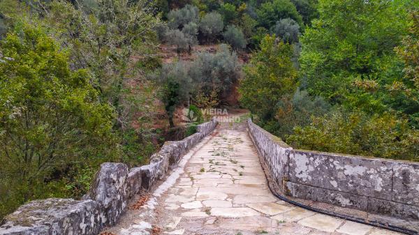
In the area of Frades, parish of Ruivães, the vigor of nature is broken by the centuries-old Ponte da Misarela, which rises more than 15 meters abo...
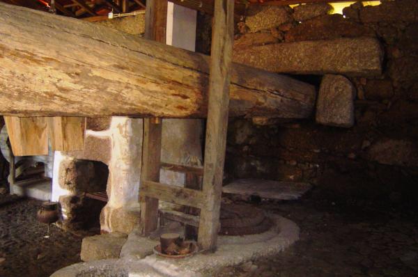
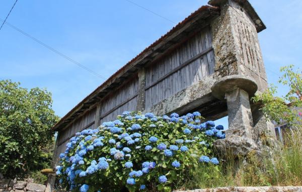
More than 300 years old, the Vilarchão oil mill was a community mill. Currently, it belongs to the Junta de Freguesia and still retains all its ori...
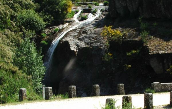
In addition to the waterfalls of Caldeirão, Candosa and Ponte de Misarela, the municipality is gifted with a unique waterfall full of mysticism. Th...
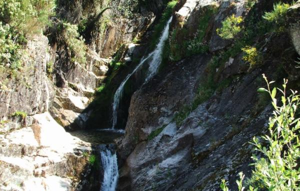
Next to the village of Zebral, on the dirt road that connects the village to Serradela, we find another fascinating waterfall, the Cascade de Calde...
Albufeira do Ermal, of unparalleled beauty, is fed by the River Ave, certainly the most beautiful and beautiful in the world and, among the Portugu...
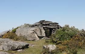
The monumental ensemble called Fojos da Cabreira is located on the slope line formed by Cortegacinhas, Alto do Seixo, Pau da Bela and Trovão, locat...
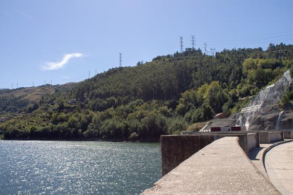
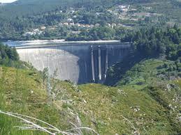
The Caniçada Dam is located in the municipalities of Terras de Bouro and Vieira do Minho, in the watershed of the Cávado River, in northern Portuga...
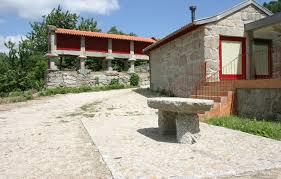
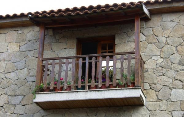
Aldeia Turística de Louredo, also certified as Aldeia de Portugal, is located in the municipality of Vieira do Minho, implemented at the foot of Se...
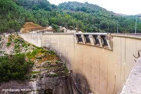
The Venda Nova dam started operating in 1951 and is fed by the Rabagão river. Venda Nova is a 97-meter high gravity arc dam. It belongs to the main...
The Salamonde Dam started operating in 1953 and is fed by the Cávado River watercourse. Salamonde is an arch dam, 75 meters high. ...
The village of Agra, classified as Aldeia de Portugal, is located in the parish of Rossas, south of the forest perimeter of Serra da Cabreira. It i...
In Ruivães, the bucolic village of Zebral rises by the northern slope of Serra da Cabreira, at an altitude of 810 meters. It is from the fields and...
The picturesque village of Espindo, with its narrow alleys and granite dwellings, is yet another typical example of a mountain village. This small ...
Belonging to the parish of Campos, land of transition between Minho and Trás-os-Montes, Campos is a typical rural village located on the northern s...
The small village of Lamalonga, certified as Aldeia de Portugal, is located in the parish of Campos, about 850 meters above sea level, on the north...
 EN
EN  PT
PT ES
ES FR
FR