EN
EN  PT
PT ES
ES FR
FR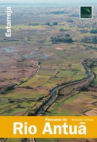
Percurso do Rio Antuã
The route of the Antuã River begins next to the Estereja de Estarreja and follows along its 6 km the banks of this River, which flows into the Ria de Aveiro. The visitor will be able to enjoy beautiful landscapes and habitats belonging to this rich lagoon wetland, where it is possible to observe some traditional activities characteristic of this region.
Esteiro de Estarreja
Estarreja
Description
* Distance to cover: About 6 Km
* Duration of the journey: Approximately two hours
* Scope of the route: Environmental, landscape, cultural and sport
* Degree of difficulty: Easy (no unevenness)
* Recommended season: All year
* GPS coordinates: [GPS 40º44’49 ’’ N | 8º34’27’’W]
Source: https://www.cm-estarreja.pt/