EN
EN  PT
PT ES
ES FR
FR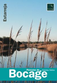
Percurso do Bocage
Description: The Bocage trail starts at Ribeiro de Canelas and follows this water line, the Ria de Aveiro branch. They are about 4 km long in a “U” shape, where the visitor can get in contact with several habitats characteristic of this region, where a rural and genuine mosaic called “Bocage” stands out.
Ribeiro de Canelas
Estarreja
Description
* Distance to cover: About 3.6 Km
* Duration of the route: Approximately one and a half hours
* Scope of the route: Environmental, landscape, cultural and sport
* Degree of difficulty: Easy (no unevenness)
* Recommended season: All year
* GPS coordinates: [GPS 40º42’19 ’’ N | 8º33’52’’W]
Source: https://www.cm-estarreja.pt/